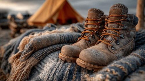
How NWS Privatization Could Impact Outdoor Enthusiasts
What happens to outdoor safety when weather data becomes a luxury? With NOAA reporting a 35% staff vacancy rate, proposed budget cuts could trigger serious disruptions in forecasting accuracy and response times—especially in remote or rural areas. For the outdoor community, the consequences could be more than inconvenient—they could be dangerous.
Private-sector tech may bring hyper-customized weather apps, but accessibility remains a concern. If key forecast data moves behind paywalls or skips over underserved regions, it could widen the safety gap for hikers, anglers, climbers, and campers.
Let’s break down how these changes could affect your favorite outdoor activities, and how to stay prepared.
How Different Activities Depend on Accurate Forecasts
Every outdoor activity requires unique weather data for safety and planning:
- 🧗 Climbers: Use forecasts to avoid high winds and lightning that can make ascents dangerous.
- 🎣 Anglers: Check weather to plan around storms and know when fish are most active.
- 🏕️ Campers: Rely on alerts for flash floods, strong winds, and storm timing when setting up camp.
- 🥾 Hikers: Watch for temperature drops, rain, or storms that could affect trail safety.
Even small forecasting delays or inaccuracies can have outsized consequences. Below, we explore the potential benefits and risks of NOAA cuts and increased privatization, broken down by popular outdoor activities:
🎣 Fishing
✅ Potential Benefits
- AI-powered fishing forecasts: Predictive models using wind, tide, and temp data can help plan more productive trips.
- Specialized apps: Tools like Fishbrain now integrate weather and fishing logs for personalized insights.
⚠️ Potential Risks
- Subscription-only access: Forecast features may cost $50–$100 annually.
- Loss of rural radar: Remote lakes could lose accurate storm alerts if radar stations are decommissioned.
- Delayed warnings: Fewer weather balloons mean slower data collection, which is critical for boat-based anglers.
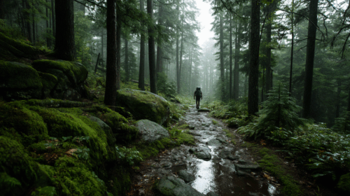
🥾 Hiking
✅ Potential Benefits
- Trail-level alerts: New apps may deliver real-time warnings for trail conditions like lightning or flash floods.
- Less urban heat distortion: Moving sensors from paved areas may improve temperature accuracy.
⚠️ Potential Risks
- Underserved backcountry: Areas like the Pacific Crest Trail may lack commercial app coverage.
- NWS office closures: Fewer rural forecast offices mean fewer area-specific warnings.
- Missed severe weather: Lightning or storm alerts may not come in time.
🚤 Boating
✅ Potential Benefits
- Advanced marine apps: Apps like Windy offer real-time wave, wind, and tide info.
- Hybrid data models: Collaboration between NOAA and private firms may preserve public buoy data.
⚠️ Potential Risks
- Buoy network cuts: If funding for offshore buoys drops, storm prediction accuracy suffers.
- Hurricane forecasting declines: Delays could repeat past disasters where fast alerts saved lives.
- Weakened international data: Reduced U.S. sharing may impact global maritime navigation.
⛺ Camping
✅ Potential Benefits
- Faster flood and wind alerts: Some tech might prioritize campground-relevant events.
- Private weather sensors: Companies may install devices in parks currently lacking coverage.
⚠️ Potential Risks
- Forecasts behind paywalls: Families may lose access to critical alerts unless they subscribe.
- Sparse rural networks: Fewer observations lead to unreliable forecasts in remote areas.
- Fewer real-time warnings: Staffing cuts may cause missed alerts during fast-moving storms.
🧗 Rock Climbing
✅ Potential Benefits
- Route-specific weather tools: Future apps may pinpoint wind or lightning risks on individual walls.
- Public-private hybrid apps: These could merge forecasts with route databases for planning.
⚠️ Potential Risks
- Premium-only features: Free apps might gate essential tools behind subscriptions.
- Mountain radar gaps: Reduced coverage in remote areas increases lightning strike risk.
- Less lead time for storms: Without balloon and satellite data, critical warnings may lag.
🐦 Birdwatching
✅ Potential Benefits
- AI migration forecasts: Predict flyways and peak birding times based on wind and weather patterns.
⚠️ Potential Risks
- Subscription barriers: Radar access for bird tracking may no longer be free.
- Weaker radar infrastructure: Tools like NEXRAD could suffer from underfunding.
- Forecast errors: Without robust input, even the best models produce faulty migration data.
🎿 Backcountry Skiing
✅ Potential Benefits
- Avalanche risk tools: Apps like Avalanche.org use snowpack data, temperature trends, wind loading, and recent avalanche activity to help assess terrain risk.
- Route planning with forecast integration: Gaia GPS, CalTopo, and onX Backcountry allow skiers to map routes using slope angle shading, sun exposure, and real-time weather overlays, helping time ascents and descents for freeze/thaw cycles or storm windows.
- Hyperlocal snow forecasting: OpenSnow delivers mountain-specific snow forecasts, storm tracking, and powder alerts at elevation, helping skiers choose safer days and zones.
- Must-have emergency app: Backcountry SOS allows users to send GPS-linked emergency info via SMS when cell signal is limited, used by SAR teams nationwide.
⚠️ Potential Risks
- Gaps in remote coverage: High-alpine zones often lack permanent NOAA or RAWS weather stations, reducing the accuracy of storm and temperature forecasts in complex mountain terrain.
- Delayed snowpack updates: Underfunding at avalanche centers like CAIC and NWAC may lead to less frequent field observations, leaving users with outdated or incomplete risk reports.
- Paywalled safety features: Key functions like offline maps, slope overlays, and terrain filters in Gaia GPS, CalTopo, and onX Backcountry often require annual subscriptions ($30–$100). While forecast data from OpenSnow remains accessible, many advanced planning tools are now behind paywalls.
🏃 Trail Running
✅ Potential Benefits
- Hyperlocal forecast tools: Runners could benefit from apps that track heat, wind, and air quality on specific trails, ideal for planning long-distance runs or race prep.
- Storm tracker integrations: Future apps may integrate real-time lightning and precipitation alerts directly into wearables or running apps.
⚠️ Potential Risks
- Heat and air quality lag: Reduced sensor data may delay alerts for heat spikes or wildfire smoke, both critical for cardiovascular stress and safety.
- Rural trail gaps: Commercial apps may deprioritize low-use trails, meaning fewer weather alerts where they’re most needed.
- Inconsistent alerts: Runners relying on app-based warnings could miss fast-forming storms if staffing cuts slow warning issuance.
Broader Impacts on the Outdoor Community
Urban Heat Bias and Forecast Accuracy
Urban heat island (UHI) effects can skew local temperature readings, often leading to overestimations by 1–2°C in densely built areas. This bias arises because urban surfaces like asphalt and concrete retain more heat than natural landscapes. Relocating weather stations to mitigate UHI effects is a recognized solution; however, such efforts are limited due to funding constraints.
Economic Significance of Outdoor Recreation
The outdoor recreation economy is a substantial component of the U.S. economy:The Outdoor Recreation Economy
- Total Economic Output: $1.2 trillion (2.3% of U.S. GDP) New Data Shows Outdoor Recreation is a $1.2 Trillion Economic Engine, Supporting 5 Million American Jobs
- Employment: Supports 5 million jobs nationwide Bureau of Economic Analysis: Outdoor Recreation
- Sector Contributions:
- Boating and Fishing: $36.8 billion
- RVing: $26.3 billion
- Hunting/Shooting/Trapping: $14.0 billion
- Snow-related Activities: $7.7 billion
These figures underscore the reliance of various outdoor sectors on accurate and timely weather data for safety, planning, and economic stability.
Risks of Inadequate Forecasting
Without robust and accessible public weather forecasts:
- Safety: Outdoor enthusiasts may face increased risks due to unforeseen weather events.
- Planning: Inaccurate forecasts can disrupt recreational activities and related businesses.
- Insurance: Underwriting for outdoor-related ventures may become more complex and costly.
Ensuring continued investment in public weather infrastructure and data accessibility is crucial for the sustained health and growth of the outdoor recreation economy.
Can AI Replace NOAA?
Artificial intelligence is revolutionizing weather forecasting, offering faster and, in some cases, more accurate predictions. However, these AI models still rely heavily on foundational data provided by organizations like NOAA.
ECMWF’s AIFS (Artificial Intelligence Forecasting System)
- Launch: Operational since February 2025
- Performance: Outperforms traditional physics-based models by up to 20% in certain metrics, including tropical cyclone tracking
- Efficiency: Uses approximately 1,000 times less computing energy than traditional models
- Source: ECMWF’s AI forecasts become operational
Google DeepMind’s GraphCast
- Launch: Introduced in late 2022
- Performance: Generates 10-day global forecasts in under 60 seconds, outperforming ECMWF’s traditional system in over 90% of tested variables
- Technology: Employs Graph Neural Networks trained on 40 years of reanalysis data
- Source: National Weather Service cuts back weather balloon launches
Huawei’s Pangu-Weather
- Launch: Released in 2023
- Performance: Completes 24-hour global forecasts in just 1.4 seconds, with accuracy surpassing traditional models in several metrics
- Technology: Utilizes 3D Earth-specific neural networks trained on decades of weather data
- Source: Accurate medium-range global weather forecasting with 3D neural networks
CalTech’s FourCastNet
- Launch: Developed in 2022
- Performance: Provides accurate short to medium-range global predictions at 0.25° resolution, matching or exceeding traditional models in certain variables
- Technology: Based on Fourier Neural Operators, enabling rapid and efficient forecasting
- Source: FourCastNet: A Global Data-driven High-resolution Weather Model using Adaptive Fourier Neural Operators
The Crucial Role of NOAA
Despite the advancements in AI-driven forecasting, these models are heavily dependent on the data provided by NOAA:
- Weather Balloon Launches: Due to staffing shortages, the National Weather Service has reduced or suspended weather balloon launches in multiple locations, impacting the availability of upper-atmosphere data crucial for accurate forecasting. National Weather Service cuts back weather balloon launches
- Staffing Vacancies: Nearly half of the 122 National Weather Service offices have vacancy rates exceeding 20%, with some offices experiencing over 35% vacancies, leading to concerns about the agency’s ability to issue timely and accurate weather warnings. Nearly half of National Weather Service offices have 20% vacancy rates, and experts say it’s a risk
These reductions in data collection and staffing not only hinder NOAA’s own forecasting capabilities but also limit the effectiveness of AI models that rely on comprehensive and up-to-date observational data.
A Collaborative Future
While AI models like AIFS, GraphCast, Pangu-Weather, and FourCastNet represent significant advancements in weather forecasting, they are not standalone solutions. The synergy between AI innovations and the foundational data and expertise provided by NOAA is essential for accurate and reliable weather predictions. Ensuring robust support and funding for NOAA will enhance the capabilities of both traditional and AI-driven forecasting systems, ultimately benefiting public safety and preparedness.
For example, Google’s GraphCast and ECMWF’s AIFS—two of the most accurate AI weather models—were trained on decades of global weather data collected by ECMWF and NOAA. This data, called reanalysis, blends past observations with model output to create a detailed picture of the atmosphere.
Without that foundation, these AI models simply couldn’t exist.
Why Human Experts Still Matter in AI Forecasting
AI models like GraphCast, AIFS, and Pangu-Weather are transforming how we forecast storms, heatwaves, and climate patterns. But they don’t work in a vacuum—they’re trained and maintained by people with deep weather expertise.
Humans Train the Machines
Behind every AI forecast are meteorologists and climate scientists who:
- Define what success looks like (e.g., predicting tornado lead time or minimizing false alarms)
- Label decades of weather events to help models learn from history
- Detect biases in datasets (like over-predicting rain in coastal regions)
- Interpret edge cases that machines might ignore
Without their input, AI would lack the context needed to distinguish between a routine storm and a flash flood emergency.
Real Judgment in Real Time
When lives are at risk, human forecasters still make the final call:
- They override AI when local terrain, storm development, or radar data tell a different story.
- They understand how to phrase alerts so people actually take action.
- They bring local knowledge and years of experience AI simply can’t replicate.
AI delivers scale and speed. Humans bring judgment, clarity, and trust.
As we embrace new tools, we need to protect the public workforce that built them.
Expert Perspectives: Innovation or Undermining Public Service?
This isn’t just a budget issue, it’s a fundamental debate about the future of public weather access.
- Pro-cut advocates argue that downsizing NOAA will promote private-sector innovation and drive efficiency.
- Critics warn that cutting staff and public infrastructure endangers safety, especially in rural or disaster-prone areas.
- The reality? Full privatization hasn’t happened, but commercialization is clearly accelerating, and the outdoor community could feel the consequences first.
How Outdoor Enthusiasts Like You Can Take Action
Help protect free, life-saving weather data with these clear steps:
✅ 1. Stay Informed
- Bookmark NOAA.gov and your local NWS office
- Sign up for mobile alerts or NOAA Weather Radio updates
✅ 2. Explore Alternatives
- Compare free tools like OpenWeatherMap and Windy
- Test which apps best serve your specific outdoor needs (trail, marine, storm, etc.)
✅ 3. Speak Up for Public Access
🏛️ Contact Your Lawmakers
- Use Congress.gov to find and message your representatives.
- Ask them to support a hybrid model that keeps essential NOAA data free and open.
📢 Share Your Story
- Post how accurate forecasts have helped, or how bad ones put you at risk.
- Use #ProtectNWS to join the national conversation.
💪 Support Advocacy Organizations
- Groups like the American Meteorological Society and NPCA work to protect public science.
- Consider joining or donating.
🖊️ Sign & Show Up
- Support petitions via Change.org and attend town halls to ask where your local leaders stand.
✅ 4. Educate Your Community
- Share this article
- Host a trail talk, campfire chat, or gear meetup focused on weather readiness
- Help others understand why access to NOAA data = safety outdoors
Final Thoughts: Weather Access Is Outdoor Safety
The path forward doesn’t mean choosing NOAA or AI, it’s about ensuring both work together. Without reliable public data, every camper, hiker, angler, and climber is at greater risk. As budget cuts loom, it’s up to us, the outdoor community—to protect the data that protects us.
Quick Action Table for Protecting Public Weather Access
| Action | What to Do | Helpful Links |
|---|---|---|
| Stay Informed | Monitor NOAA updates and NWS alerts | NOAA.gov, weather.gov |
| Explore Alternatives | Try free tools to supplement forecasts | Windy, OpenWeatherMap |
| Contact Lawmakers | Ask reps to support a hybrid public-private model | Congress.gov |
| Share Your Story | Use #ProtectNWS to share weather-related outdoor experiences | Your social media platform |
| Support Advocacy Groups | Donate or join science defenders | AMS, NPCA |
| Sign & Attend | Join petitions or town halls | Change.org |
| Educate Others | Share this post and organize weather-safety talks | Local clubs, trails, or online groups |